Wednesday, July 23, 2014

Ultramaraton de los Canones in Guachochi, Chihuahua 2014 Race report

Dusk at Sinforoso Canyon night before race

I had a great time at the 18th running of the Ultramaraton de los Canones in Guachochi, Chihuahua.  I wanted to share the experience with all of you who may consider this event in the future.  There is not much written about this event in any "blogs" so I went into it with very little knowledge of what to expect. I hope to inform  readers of this report as to how difficult but how beautiful and truly unique it is.  At the end, I will compare and contrast with the Ultramaraton Caballo Blanco in Urique which I have done twice before and have written about as well.

Training
For me personally, the training for this event was not optimal.  I had come off my first DNF at Western States 3 weeks before after running 90 miles and reaching the time cutoff.  I was not able to run after that race for about 10 days due to my quads getting trashed.  More about Western States here:Western States 100 race report. Not only was I physically not in a good place, but mentally I was having difficulties accepting that I had DNFd my A race for the year.  It was hard for anyone to relate as everyone thought 90 miles was "pretty amazing", but to me it was a failed effort that I needed to put behind me.  I ran easy on roads and the weekend before did some easy trails as I was recovering and tapering at the same time.   In hindsight, here is really no place adequately prepare for this race.  No trails in El Paso match the technical and elevation gain of this Ultra, more about that later.
Parral, our first overnight stop

Getting There
For many people, one obstacle to participating in this event is the perceived difficulty and danger of getting to Guachochi.  I have done 2 prior races in the Copper Canyon and had no concern what so ever.  We had a group of 8 total runners from El Paso and New Mexico/California that would be making the trek together, for that we had 2 cars.  I rode with Alfredo H, his wife Pamela M, and Pam's sister-in-law Myriam.  In another car were Jaime H, Nancy K(from Santa Barbara), Miguel C, and Kelley K. (from Santa Fe).  We left Thursday at approximately 2 pm, which allowed me to work half a day, and stopped at the Santa Teresa point of entry.  We got our visas and drove down to Villa Ahumada for the requisite stop to eat quesadillas and Mexican coca cola. From there we drove to Chihuahua City and then to Parral, Chihuahua for a planned overnight stay. We arrived around 9 pm, pretty hungry and stopped to eat first at the Vaca Voladora Restaurant. From there we drove to the Hotel Americano and got 3 rooms for the night.  Next AM,  Friday AM, day before the race, I had planned to run 2 miles easy.  Kelley had a different idea as we got started said she wanted to go up to a statue she had seen lit up the night before.  So it was that we ran towards the statute trying to find a path to the top. It was pretty technical and there really was no trail but we made it to the top.  The views of the city were spectacular and made it worth the effort.  There was also an old silver mine that we got to see.  Many years ago, Parral was known as the World's Silver Capital and was felt to have the best quality silver.   On the way back, we took a different route and got lost, making our run a total of 4.5 miles.
going up to statue in Parral
On the way to St Joseph Statue

We ate breakfast at the hotel and joined the others on a tour of the city before starting the final drive to Guachochi.  We arrived at around 3 pm and went to have a late lunch/dinner at the restaurant El Corral. From there we went to pick up our packets and there was a long line and they did not have Pamela's bib which delayed the process even more.  It was not very well organized and was unnecessarily lengthy, in my opinion.  There was a 10K race at 5 pm in the city streets on Friday going on at the same time. After that,  Kelley, Nancy, and I drove to see the Mirador or place where you can see the Sinforosa Canyon.  Nancy was not racing with us and we wanted to show here how to get there for the next day.  There we had some spectacular views of the canyon but it got dark and we had to head back to town, arriving around 9 pm.  There is a pasta dinner and orientation at 7 pm which I did not attend but Miguel did and he found it helpful.
Packet pick up L to R  Jaime, me, Myriam, Pamela, Alfredo, and Kelley


Race Morning
The race begins at 5 AM and we needed to be there early for check in.  I set the alarm for 330 AM but was awake before the alarm.  We had the unpleasant surprise that there was no water that morning which caused some complications. I ate a Kind bar, banana, and a Cliff Bar with water for breakfast. We drove to the starting line and got a bracelet to indicate we were at the starting line and checked in.  That process was quick and may allow one to arrive later and get extra sleep if possible. We lined up at the starting line and the race started on time.
Race AM, ready for battle R to L Alfredo, Pamela, Myriam, Kelley, Jaime, me, and Miguel


THE RACE

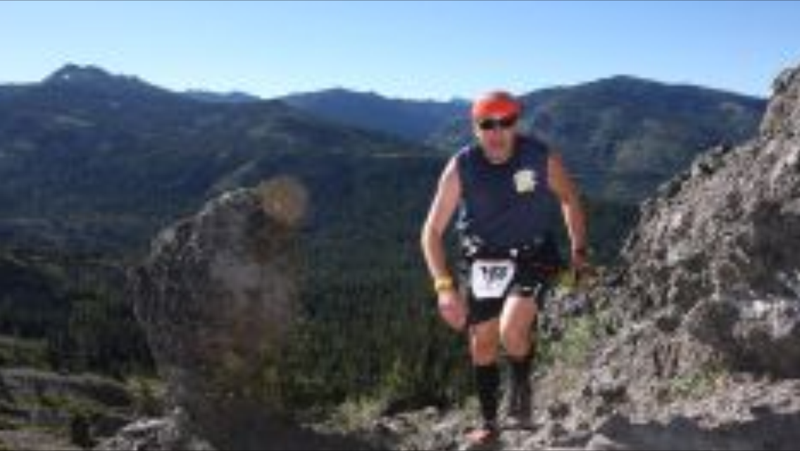
I am going to divide the race into 5 sections which are very different to help illustrate what to expect.  The first is from Guachochi to the edge of the canyon, the second is from the top to the bottom of the canyon, the third is along the river and up El Chipote, and the fourth is the climb back out of the canyon, and the fifth is the return to Guachochi.  For gear, I had brand new compression trail shorts and top from Compressport which Laura had suggested.  I also had calf compression gear and a Salomon hydration vest with 1.5 Liters of water.  I carried two empty 20 oz. bottles in the front to fill later.  I carried a whistle, an emergency blanket, a water proof jacket, and a small flashlight.  For food, I had several Kind Bars, CLiff Bars, Gu, and Endurolyte salt tablets by Hammer. I also had Black Diamond adjustable climbing poles.

Guachochi to Edge of Sinforoso Canyon
We left the main town square where the race begins on paved roads for about 1 mile and headed out to the canyon on the road I had driven the night before.  I was pretty dark and most runners had headlamps.  I did not have a headlamp because I knew that the sun would come out soon and did not want to carry it for the rest of the day. I did have a very small flashlight, which was helpful and for safety in case dark fell on my way back that day on the way back.  Retrospectively, I think it would be better for EVERYONE to have a headlamp because when it gets dark, the canyon can be a very dangerous place with no light.  I went an easy pace to save my legs for the 63K (39 mile) journey that was ahead of me. The elevation, I should point out IS an issue and we started at 8,000 feet from the city with a slight elevation gain to the canyon. This part was mostly paved and unpaved roads up to the point at 5 miles where the first aid station was.  There, they had "drop bags" and some runners with family drove their cars there to meet the runners. In theory, one could have them take the hydration packs there, which some people did, but I would not recommend it.  I heard of at least one person who arrived to find he did not have his gear there.  After that, we went on single track trail towards the canyon.

Edge of Sinforoso Canyon to Bottom of the Canyon
Once I arrived at the edge of the canyon, the views were spectacular.  I had seen it the day before, but some people were seeing it for the first time.  Many runners stopped for pictures at this point.  It is also said, some runners have in the past been so intimidated by the sight of the canyon that the abandon the race at this point. This downhill section is gnarly and technical.   I found myself along with the others slipping and falling on my butt countless times.  Rocks would occasionally roll down and everyone would yell, "Piedra!". Probably a good word to learn if you are not fluent in Spanish. I had never trained or used the poles before, so I had to figure out how to make use of them.  One runner badly sprained her ankle and told me she had heard a pop.  The next day she told us how she had to climb back up because she knew she would not make it as she had done it before.  There were several "conga lines" that formed on the trail and I had to pass some of them.  On the way down, we passed several streams and creeks.  I stopped to fill my 20 oz bottles and drank from the stream.  They had told us it was OK to drink from the first river but not the second river, so I drank a little bit and poured water which was cold on my head.  In one of the 20 oz bottles, I put iodine tablets that Miguel shared with me.  The other bottle, I would use to pour over my head to keep cool as the temperature started to rise rapidly.  As I said earlier, for the readers who live in El Paso, there is nothing to compare or train for this section. The footing was loose and the angle of descent was more steep than anything I had encountered in the past.  At the bottom, approximately 3,300 feet, there was an aide station which consisted of a couple of guys with bales of water and pinole (a corn based drink) that was being stirred with a stick.  I decided to pass on that as I did not want to get sick.
Initial descent, photo by Alfredo H.


Route along the river and up El Chipote
Once we arrived to the bottom of the river, you reach a run-able flat sandy section, which I was able to gain some time. The temperature was starting to rise and I was running out of water. We passed several streams but I did not trust the water quality.  We then started to climb again, a mountain next to the the river which all the runners called El Chipote. Looking at the Strava data, it only goes up to 3,800, an elevation gain of 500 feet, but the bottom of the canyon was pretty hot, and as I said, I had run of water. I then reached an aid station called "la cueva" which means the cave in Spanish because there is a cave next to it.  Here I filled my hydration vest and 2 bottles.   I inquired the volunteers, who were great, where the water came from and they explained that it was from spring water nearby which they hauled over in a big bucket.  For Gatorade, they had the powder which they carried down from Guachochi and mixed for us. During this section, I encountered a group of runners that had gotten lost and ended up down close to the river.  They believed they has been lost for an hour but as happens in this cases, it always feels like you lose a lot of time.  The course is marked by red ribbons as there is no "trail" to follow in some sections.  I had several occasions where we went off course for a short distance and had to backtrack to find the red ribbons.  In the beginning, I tried to keep my feet dry and jump over rocks at stream crossings.  It was at a stream crossing that I slipped on a rock that was wet and jammed my thumb on my pole against the rock.  I fell right in the stream and from that point on decided that I didn't care if  my feet got wet.  I took the opportunity to soak in the stream for several minutes up to my waist to cool off.
Pamela on the rocks (photo by Alfredo H.)


Climb out of the Canyon
After the climb up and then down the Chipotle, we passed next to a small creek, and from here you could see the top of the canyon where the Mirador or lookout point is at.  That was the point we had to climb to, 4,800 feet of elevation gain in about 6 miles.  By this time, the mid day sun was bearing down and the temperature was up to 99F according to my Suunto watch. The climb is very steep in several sections and sometimes require "boldering" through large rock formations.  These sections required me to put both the poles in one hand and climbing on hands and knees.  Some of the runners had climbing gloves to protect the hands from rocks.   On the way up, we passed another aid station next to to a stream and once again I sat in the water and poured water on my head.  From here we climbed a section of switchbacks that was very exposed and hot.  The next aid station is next to a beautiful water fall.  Here I loaded up with more spring water and drank several cups of Gatorade.  This is where I caught up to Jaime who was asking the volunteers if they had any ice, I thought he was delusional from the heat.  As I left the aide station, I had a horrific cramp in my left quad that stopped me in my tracks.  I sat in the shade and waited for it to pass.  I took 3 endurolyte tabs with water and it finally subsided to the point where I could resume.  The next milestone we reached was "the wall" where the trail narrows along the side of the canyon and the drop is about 2,000 feet.
More climbing, shows how gloves may have been helpful

Pam negotiating the Wall (photo by Alfredo H.)


After this section we reached the swinging bridge after which there was an aid station where they had bottles of water, electrolyte solutions, and even ice. The next mile and half is a road that climbs pretty steep for another 900 feet to get to the edge of the canyon where the Mirador or look out is located. It was on this last section that I ran into Nancy who had driven there to meet us.  She walked with me and carried my pack to the car leaving me with a hand held to finish the last 8 mile section.
Pamela climbing back out of canyon (photo by Alfredo H.)


Mirador to Guachochi 
This is a run-able section of the course if one still can run.  I surprisingly was able to run most of it to the end.  It follows a completely different road back to town after passing some open fields with single tract.  There are aide stations every 3 Km and you pass the 100K runners coming back from the city which loop back to the swinging bridge for the additional miles.  At the aid stations, I had coca cola, bananas, and electrolyte solution.  My watch lost power at this point so I could not keep up with pace but knew the time.  As you arrive at the finish, there were many spectators lining the street encouraging you and I got followed by an ambulance that was escorting the first female 100K finisher.  As I arrived at the finish, I received a Finisher's medal.  I looked at my watch and it was 7:15 pm meaning I had taken 13 hrs. 15 to complete the race.  The official results have not been posted yet, so I am not sure of the exact time.  Afterwards, I was filled with emotion and cried from the relief of having completed this tough event 3 weeks after my DNF at Western States.  I kept thinking, this is my Placer HS finish, this is the finish line that I did not get to experience in Auburn. It was a cathartic experience and made me realize how much it had bothered me not to have finished.


Post Race
After finishing, I walked to the apartment where Miguel was as he had completed the race in 11 hrs. 44 min.  I showered and walked back to the finish line to meet the others.  Jaime was driving back after having completed in 14 hrs with Nancy.  After dropping him off at the apartment, Miguel and I went to get Kelley who had finished just as it was starting to rain quite heavily and was dark.  Alfredo, Myriam, and Pamela would have the most difficult experience of the last 2 hrs in the dark and rain, but finished in a little over 17 hrs.  As the results are not out yet, I don't know the percent that did not finish.

Comparison to Ultramaraton Caballo Blanco
Having completed both races in the canyons, I wanted to compare the two events for anyone who may be interested.  Caballo Blanco in Urique has many more people from outside Mexico due to the book and the Mas Locos who attend make it a truly special event. Guachochi has many more events, a 100K, a 63K, and on Sunday a 21K.  There seemed to be many more Raramuri runners in Caballo Blanco because they receive corn vouchers for completing even one loop of the race and more for finishing the 50 mile course.  At Guachochi, they don't give corn vouchers.  As far a difficulty, the Guachochi race is much harder and more technical than Caballo Blanco.  Guachochi is also more self sufficient because the bottom of the canyon is inaccessible compared to the jeep roads which Caballo Blanco follows.  In terms of natural beauty, the Sinforosa Canyon is spectacular and you get to run on it.  The Caballo Blanco race starts and end in Urique which is at the bottom of the canyon.   In short, I think both of these races need to be experienced.

Post script
Overall, I had a great time traveling down with the group from El Paso.  It is a quick and relatively affordable trip to a very exotic land for a tough challenge.  I want to thank Nancy for being such a great sport in crewing for us. To Alfredo for driving us there and back while Myriam and Pamela drank beer all the way down.  To Jaime for driving the other vehicle and making the reservations for the apartment in Guachochi.  To Kelley for inspiring me to go to do this race, you were an inspiration to all who met you on this trip.  Miguel who was such a great travel companion to all of us as well.  I also want to thank the organizers and volunteers who hiked down the canyon to meet us an provide aid or to make sure we arrived safely at the various checkpoints or to get bracelets. Now is on to the next event, the Ultratrail Mont Blanc in the French Alps. I will be blogging about this race as well.  I hope to complete the 100 K in less than 16 hrs and thereby get on on the lottery again for Western States as I have unfinished business there!


Saturday, July 5, 2014

Western States 100 Endurance Run DNF report


I had a great time and learned a lot from my first DNF (did not finish) of my short racing history.  It is a cliché, but it is said you learn more from a DNF than race you finish, so I'm going to put into practice. I hope to provide a perspective of the race that may help others in the future who may be planning to do this race as well as to share the experience with everyone.

Pre Race
I arrived to Squaw Valley on Monday of race week to attend a medical conference and which I summarized in the blog.  On Thursday, they had lectures for crews and for athletes about the course with some helpful insights provided.  On Friday, I went to Reno to pick up Kelley Koehler who would crew me for the race.  She is an accomplished ultra marathon runner and Triathlete who I met at the Caballo Blanco Ultra in 2013. We also travelled together to Urique in 2014 for the Caballo Blanco Ultra.   After a quick stop for supplies at the local food mart, we took the drop bags to the designated location.  I prepared a total of 10 drop bags with extra nutrition and gear which I will discuss later.. 

Leaving drop bags on Friday


 I then went to get registered.  I received a bracelet, got weighed, and received a ton of great swag. I also participated in a medical study on gastrointestinal (GI) problems in 100 mile runs, so I met with the investigators.  They drew blood for analysis and to compare to after the race.  Since I got there late, there were no lines and the process was quick. 

Checking in at Western States 100
getting weighed in at Check in
Blood draw for GI distress study

At the end of check out, they take a picture of the participants, I guess to keep tract.  They are all very professional and organized.  They used to check blood pressures before the race, but this year they stopped doing it.  In the medical conference, Dr. Marty Hoffman mentioned that they decided they didn't need to do this after having done for many years.
Profile picture at WS 100

After registration, we went to the expo and registered Kelley as a pacer.  Chris "Tarzan" Clements also joined us to register as a pacer. Pacers in 100 mile runs typically run along for safety for the last 40 miles.  At Western States they are also allowed after 8 pm at mile 52.  I had never met Chris but he heard I needed a pacer and was interested.


Kelley my crew and Chris "Tarzan" my pacer

In the afternoon, there was a mandatory meeting for all the athletes.  The highlight for was seeing the elite male and female top 10 being introduced.  After dinner, we Kelley and I went to the condo and watched the movie "Unbreakable" about the 2010 race and I was in bed by 9 pm.  I fell asleep in about 1 hr. I woke up at 3 AM before my 3:30 alarm had gone off and started getting ready.  Ate a banana, almond chocolate milk, and some prosciutto. At 0415, I put away all my luggage in the car and headed to the start to pick up my bib and get weighed.  I also stopped by to talk to the GI study investigators and swallowed a LARGE pill which was a thermometer which would be used to measure my core temperature during the race.  They asked me whether I was having any GI distress and what I had eaten for breakfast.

THE RACE
I am going to break the race down by aid stations and talk about each section of the course.  That is how I approach a 100 mile race, its aid station to aid station, trying not to think about 97 more miles to go at the top of the first climb.  This may help someone who in the future is doing race to get a better idea of the terrain and what to expect.


Squaw valley to Escarpment 3.5 miles
The race starts with a 3.5 mile uphill section with over 2,500 feet elevation gain from 6,250 feet to 8,750 feet at Emigrant Pass.  I had decided that I would go this section very slow to keep from getting anaerobic and save energy.  The road is a smooth incline on a jeep road. My planned pace was 20 min/miles which I was able to stay pretty closely.  Since I was towards the end of the pack, I got to hike up with Gordy Ainsleigh and he was very talkative.  Gordy started this race 41 years ago (more in blog post from Dec) and he shared with me a lot of insights about the past.  He has an encyclopedic knowledge of the race and he was a joy to share the trail with.  I also met Tom Green in this section as we hiked.  Tom is now 63 and was doing his 10th Western States race. I would later find out was the original "Grand Slammer" who 30 yrs ago did the four 100 mile races that existed at the time (Western States, Vermont 100, Leadville 100, and Wasach 100) in the same summer.  At the top, I stopped to take the view of Lake Tahoe and the beautiful view that is a sight to behold.
Going up to Escarpment WS100 2014

Escarpment to Lyon Ridge 7.0 miles
After the climb to Watson's monument, the trail becomes a gentle downhill on single tract. I settled into a comfortable pace, conscious that I did not want to go to fast so as to "save" my quads for later in the race.  I hiked the short up hill sections as well.  This section is largely above 7,000 feet and has on some years a lot of snow.  This year there was no snow but few creeks and streams to cross.  I largely kept my feet dry in this section. As you follow a mountain ridge line, the views on both sides are spectacular.  When I arrived at the aid station, I refilled my hand held 20 ounce bottle and my waist pack 8 oz bottles.

Lyon Ridge to Red Star Ridge 5.5 miles 
This section is still above 7,000 feet elevation with some short climbs and descents along the ridge line.  The pace was good but I was affected by the DUST, there was al lot of it, specially with long "conga" lines that formed in the trail.  I tried to use my buff to cover my mouth but it made it harder to breath. There were also a lot of lose rocks and technical sections.  I arrived to Red Star Ridge at 9:15 AM which was putting me behind my projected pace.  I had a drop bag there and another 20 oz. water bottle.  I refilled my pockets with GU, Cliff bars, and salt tablets.  I said hello to Rhonda, Rich and Jonathan who were in the medical tent and who I'd met at the medical conference earlier in the week.

Red Star Ridge to Duncan Canyon 7.8 miles
We continued to descend with few uphill sections interspersed.  I caught up to Jess Soco in this section.  I had met her at the Caballo Blanco Ultra and she was running with Luna sandals. We spoke briefly and I passed her.  The dust continued to be a problem is this sections and we were still at elevation.  Occasionally, I would feel a twinge in my right ankle from the injury I had sustained 6 weeks before.  It was mostly when I stepped on a rock and my ankle twisted.  It was a reminder that I had not really been able to train well the last one and half months before the race. Once I arrived at Duncan canyon it was about 11:30 am and the sun was starting to warm things up.  I used a zip log bag which I was carrying to put ice and placed it under my buff and another in my stomach. This race provides a lot of ice for the runners and I took full advantage starting at this point.
Beautiful views of WS trail


Duncan Canyon to Robinson Flat  5.9 miles (30 mile point)
This section begins with a gradual descent followed by a steeper ascent up to the aid station.  I was still feeling good eating Cliff bars, GU, and salt tablets along the way. I power hiked the uphill section at the end.  I was using my Suunto (Ambit 2) watch but had changed the GPS setting to check every minute instead of every second.  This conserves battery but the accuracy is decreased in terms of miles covered and pace in minutes/mile. As a result, I never really knew how far I had gone or how far it was until the next aid station.  When I arrived at Robinson Flat, I got weighed for the first time, I was up 2 pounds from the morning weight.  The GI study people measured my core temp which was 101 F.  They collected all my wrappers from the food I had eaten, and asked me whether I had any GI distress, which I had none. (except gas a little).  Kelley my crew was there and we got my drop bag where I had my Salomon hydration vest.  We filled it up with water and I ate some potatoes.

Robinson Flat to Miller's Defeat  5.6 miles
Leaving Robinson Flat, you start with a steady climb for about a mile.  I felt really heavy carrying all the water bottles plus the hydration vest. In hindsight, I would have liked to have carried less stuff but I was worried about the canyons to come later in the day and wanted to stay hydrated. After the initial climb, there is a long descent that is really exposed due to the fires last year. Several people passed me in this section and I had a low point here.  Rich H. was one of those who caught up to me here, he is Maude's brother, a Nurse Practitioner who I work with.  He is a physician from the Bay area and was doing the race for the first time as well. Before I got to the aid station, Jess Soco caught up to me again and told me she was worried about the cutoff, which she thought was at 2:30 pm.  I told her it was at 3 pm for I was carrying my pacing chart.  We arrived at 2:30 and I got some more ice. Jess made a quicker stop and was gone before me.

my pacing guide
Miller's defeat to Dusty corners (2.7 miles) Got Lost and did extra miles
This section is initially flat with some rollers and then steadily goes down Last Chance Rd, a jeep road, which is pretty run-able.  I once again caught up to and passed Jess along the way and then as I was going reached the end of the trail I was in.  I did not see any markings and that is when panic set in. I had missed a turn on the trail and had gone probably a mile or so further.  I started heading back and was yelling for help and finally after about 15 min, I saw another runner taking a turn down a different trail and caught up to him.  I asked if he was sure this was the correct trail and he said, "I'm sure, that is Gordy Ainleigh in front, and I think he knows the route!".  When I arrived to Dusty Corners, Kelley was there to surprise me after having driven for 1 hr. like a speed racer to meet me.  She said Jess had passed about 15-20 min ago and had seen me take a wrong turn but was unable to get my attention. I was pretty upset with myself but had to keep going and get over it.  Gordy was there as I left the aid station, looking pretty tired.  I was 35 miles into it and I was at the same place as Gordy, that left me worried as to whether I would finish.

Dusty Corners to Last Chance 5.3 miles
We continue on Last chance road through several rolling hills. At this point I ran into Melanie from Oregon who was also doing Western States for the first time and her first 100 miler.  She was pretty discouraged and I tried to pick up her spirits. She also had gotten in with the lottery and qualified with a 50 mile race.  This is the last year you could gain entry like that.  I always liked the name Last Chance for an aid station and they were pretty cool.  I loaded up with ice and prepared myself for the canyons.

Last Chance to Devil's Thumb 4.5 miles 
Initially, the descent form Last Chance is pretty gradual but then it becomes quite steep with many switchbacks for about 2 miles down to the Swinging bridge of Deadwood Canyon.  Unfortunately, the bridge was damaged in the fire and was not usable.  A new section of trail was created with a cable crossing of the river.  This is the first time my shoes, Salomon S-Lab Fellcross, got wet and then we had an equally steep climb out to the canyon for about 2 miles and 1800 feet elevation gain. I arrived at Devil's thumb at around 6:30 pm which was 30 min before the cutoff .  I would be chasing the cutoffs for the rest of the race, good thing I had them written down on my card.

Devil's thumb to El Dorado Creek 5.1 miles
This is the second canyon that we pass along the way.  The descent is not nearly as steep as the descent to Deadwood Canyon and this is where Jenn from Kentucky caught up to me and Melanie.  She had a good pace going down the hill and I decided to latch on to her.  She loved to talk like me on these races, my spirit animal is the Loro (Parrot), and she had a great attitude.  She was doing the math and reassured me and Melanie we could finish in less than 30 hrs, because I was increasingly getting worried and pessimistic.  We passed the 50 mile mark on this section and we had run for about 15 hrs. with the "easier" sections to come.  I stayed with her until the next aid station which is after a bridge at the bottom of the canyon. Melanie couldn't keep up with us and eventually dropped at mile 70.

El Dorado Creek to Michigan Bluff 2.8 miles (55.7 miles covered)
This is a mostly uphill section, I had left Jenn at the aid station and climbed up as fast as I could power hike.  It was starting to get dark and it was here that I came upon Rick, who was having GI problems and had been vomiting.  He looked pale and I told him so.  I offered a salt tablet which he took and after 5 min, I pressed on the trail.  Kelley was at Michigan Bluff waiting for me and hiked the last section with me.  Once again, I got weighed and got temperature checked for the study.  I sat and Kelley had prosciutto and almond chocolate milk for me.  She took off my shoes and socks and checked my feet telling me they did not look "too bad."  I was pampered there with all the Mas Locos in attendance.  Maria, Tyler T., Krista, and my pacer Chris.  (Chris' brother Tyler was also there).  Kelley put on my socks and now I would switch to the Hokas for the rest of the run. Kelley would also be pacing me to Forest Hill as it was after 8 pm and pacing is allowed here after that hour.
Coming up to Michigan Bluff mile 52.7


Michigan Bluff to Forest Hill  6.3 miles
This section is initially flat but then goes uphill for a nice portion followed by a steep descent to another smaller canyon.  I carried a head lamp and another lamp around my waist to see the trail. Kelley had a pretty bright headlamp and stayed behind me except where we had room to run next to each other.  It was nice having company and we talked a lot of the way.  I could not run the downhill sections and was having to walk pretty slow down. My quads and hip flexors were hurting with every step and the steeper the trail the pain became intolerable. We passed the Bath Road Aid station and then we arrived at the road leading to Foresthill.  At Forest Hill, I was weighed again and I met up with my next pacer, Chris "Tarzan" Clemens.  I got word that Chris was interested in pacing from a friend of Kelley, Nancy who lives in California and was willing to come up for the weekend. I joked with him that when selecting a pacer, you have 2 choices, someone who knows you but does not know the WS trail or someone who is familiar with the WS trail but does not know you.  In his case, he was neither as he and I had never run together and he had never done the race before.

Forest Hill to Cal-2 (Peachstone)  8.7 miles
Chris was a great pacer, he was encouraging me and supporting me the entire way. After leaving Forest Hill the trail goes down hill again, but now I was getting to the point that I really could not move downhill very fast. This would cost me the race as I would come to find out.  I got so bad in sections that I was holding on to tree branches to slow me down and diminished the impact on my legs of walking down the steeper sections of trail. Surprisingly, I could still shuffle on the flats and power hike the ascents, I just could not descend at all. We arrived at Cal 2 at approximately 2 AM and the cutoff was 2:30.

Cal-2 to Rucky Chucky 7.3 miles (78 miles covered)
Since I could not do math, Chris was very good about keeping tract and let me know we had to get to Rucky Chucky by 0500 or we would not be allowed to cross the river. The initial section to Ford's Bar was steep but then it levels off and I was determined to make the river.  I pushed as hard as I could on the flats and walked, power hiked the ascents.  The downhills were impossible to cover with any speed. We somehow managed to get to Rucky Chucky at 0430. The place was lit up on both sides of the river and at that hour it was surreal.  A friend said that it reminded him of a scene from the movie Apocalypse Now, and I think that captures the image perfectly.  I got weighed on the near side and crossed via a cable with folks guiding you to avoid large rocks in the river bed.  They had glow sticks submerged on top of the bigger rocks.  The water was waist deep in many places and I was soaked.  My legs did not appreciated the cold water and I got a chill after coming out the other side.
Crossing Rucky Chucky at 5 AM (I am glad Chris is smiling?

Rucky Chucky to Green Gate 1.8 miles
This section is a steep up hill and the sun was starting to come up again, the second sunrise of this adventure.  Near the aid station, Kelley was waiting to meet me and as usual she was great.  She was carrying some almond chocolate milk and extra food.  I stopped briefly at the PortoPotie (bye bye temperature pill) and left my head lamps with Kelley.
Green Gate to Auburn Lake Trails 5.4 miles (85.2 miles)
We left Green Gate at 5:30 or so and had to be at the next aid station by 7 AM or we could not keep going.  At this point, I decided to push as hard as I could now that the sun was up and I put my music on a rock play list to motivate me.  This section is runnable and not so steep which helped.  I was passed by Tom Green in this section.  He would be the last official finisher at 29:57:32 earning him his 10th finish.  Jen also power hiked her way past us and finished in 29:49.  Chris as usual was encouraging me and towards the end we could hear the music and we knew we were close. We arrived at 6:56 AM and I got weighed and was out of there as fast as I could. Chris got my water bottles filled while I was being weighed and as we were leaving heard the horn that signals that the cutoff has arrived for the aid station.
Auburn Lake Trails to Brown's Bar 4.7 miles  89.9 miles covered and place where I dropped
The next section is 8.3 miles and we had to be out of the Highway 49 aid station by 9:20 AM.  That gave me 2 hrs and 20 minutes to cover 8.3 miles.  I reached another low point here and wished that I had missed the cutoff at 7 AM so I could rest.  I pushed as hard as I could but I was finding it increasingly difficult to move.  We arrived at Brown's Bar and I briefly saw Hal Koerner there, he has won the race 3 times and was working the aid station all night. (what other sport would you ever see that?)  I kept running down the hill and Chris caught me at the bottom of the hill.  That is when I saw the climb that was in front of me, I looked at the time and we had about 45 minutes to get to Hwy 49, which was 3.6 miles away and uphill.  I decided I would not make it and that my health was possibly in danger. I told Chris that I would drop and go back to Brown's Bar. He gave me a big hug and we hiked up to Brown's Bar where I officially dropped.  They tore my chip off and wrist band and I was officially a DNF. I had gone 90 miles in 28 hrs. and that is as far as I could go.

Chris and I got a ride back to Placer HS, the finish point of the race with a guy from Ashland, Oregon.  I don't remember his name, my mind was trashed along with the quads at that point, but he had paced an elite to the finish and then went to work the aid station all night. It is people like him, Hal, and Anne Trayson (15 time winner), who volunteered at Robinson Flat (Kelley got to talk to her there) and then went to Rucky Chucky to find someone who may need a pacer to run with them in the rest of the way. She has done this in the past.

I arrived at Placer HS and ate some eggs and watched Jess Soco and Jen and Tom Greene arrive at the finish.  Gordy dropped at Forest Hill (mile 62) which is pretty good for 67 years old with an arthritic hip. He incidentally told me the VA has agreed to pay for stem cell injection into the hip.   Rick recovered enough from the nausea to get to Forest Hill where he also dropped.   I went to the medical tent and told the GI study folks that I had dropped.  They took my blood again for studies.  I then had a needle drainage of my second right toe which had developed a subungal hematoma (blood under nail).
Subungal Hematoma post drainage
John Vonhoff who wrote a book called "Fixing your Feet" and is an expert on runner's feet looked at my toenails very disapprovingly and told me how to cut them and file them down to prevent these types of injuries.

The results of my lab work were post race:  Sodium 133 (normal around 140) which means I was slightly hyponatremic, BUN 38, Creatinine 1.58, and Creatine Kinase (CK) was 46,025. The upper limit of normal is 500 IU.  I got these results the next day and I made sure I hydrated to prevent rhabdomyolysis.

Of note, there were 376 starters, 296 finishers, and a Did not start (DNS) rate of 5.8%.  Finish rate was 78.7% which is higher than most years.  129 silver buckles (less than 24 hrs) were awarded. The high in Auburn was 89 and the low 59, so not as hot as previous years.
At the finish line with Chris and Kelley
Afterwards, I went to hotel and showered and attended the award ceremony where I slept on a chair in the shade.  We all went to lunch and said our goodbyes.  Looking forward to the time we all meet again.

R to L. Me, Kelley, Chris, Maria, Tyler C., Crista, Jess S, Patrick S, and Tyler Tomassello. Photo by Luis Escobar

Post Script
I had an amazing time at the 2014 Western States 100 Endurance run. The event lived up to expectations in every way imaginable for me.  The course is amazing and tough, the volunteers, my fellow runners who were in the front of the pack and the back of the pack were a joy to meet.  I learned a lot about myself and how I want to approach these races in the future.  I recognize that I lost 6 weeks of good training at the end which hurt me. I probably went too slow in the beginning and I was careless to get lost. I probably ate and drank to much early on and carried to much weight with the vest and other water bottles.  I hope some day to get another chance, have to hope I'm lucky again in the lottery.  Now its on to Guachochi 40 miles in the Copper Canyon in 2 weeks and another great adventure.

Many thanks...
I want to thank the race organizers and 1,500 volunteers who made this race possible for all of us. Maude and Rick, it was nice to spend time with you before the race and out on the trail.  To all the fellow Mas Locos, including Jess, I appreciated all you did for me along the way.  Chris, my pacer, I could not have asked more from you, you were spot on in terms of support and guidance during the race. Kelley, my crew, she was there every step of the way and provided me with invaluable assistance.  Could not have done it without you.  I return, I hope to one day crew or pace one of you or someone else so that I can give back to the community of ultra runners of which I am so proud to be a member off.